Sea Monsters and Ice Cream: Hiking With Kamino in Kelowna British Columbia
Here’s a little secret of ours: we’re now living in one of the most beautiful areas in Canada, and we’ve hardly begun to explore it.
So we were thrilled when Kamino approached us to share a hike through our new city. Kamino is a great app for travel that lets you make and share urban hikes on your smartphone. While most hikers head out of the city to stretch their legs, Kamino features in town urban hikes with a strong emphasis on local sights and activities.
This suits us fine as we love exploring the cities we stay in when we travel. Whether we’re going for a walk through the colonial centro of Merida in Mexico, checking out a flamenco bar in Seville, strolling through the squares in Madrid, or wandering the maze-like streets of Marrakesh we love walking around town.
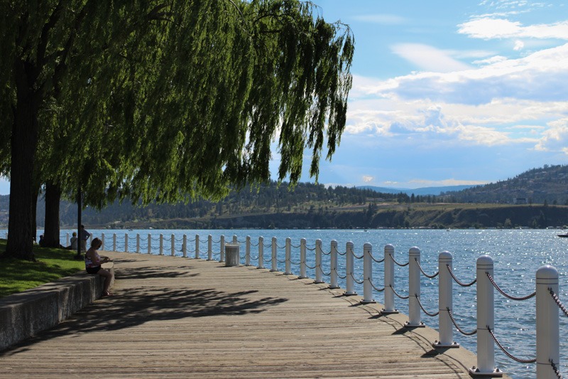
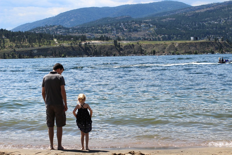
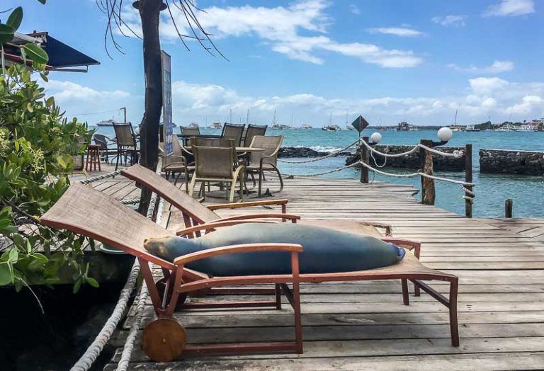
It’s a cool concept, so we thought we’d kill two birds with one stone: Check out the Kamino app and explore the beautiful waterfront in Kelowna, British Columbia. Our trip around Kelowna takes you along the waterfront of Okanagan Lake, one of British Columbia’s longest and deepest lakes. Lake Okanagan is even said to have its very own lake monster, a giant serpent-like beast named Ogopogo though it’s been a few years since its last “sighting”. We created our hike to guide you around the festivities on Canada Day, but you could take the walk anytime.
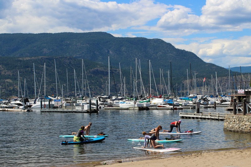
Hint: Our hike may or may not involve ice cream, grilled cheese, an Ogopogo sighting and yoga on a stand up paddle board.
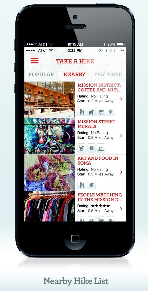
We planned our own trip around our city, but you can also follow someone else’s hike. Like all other Kamino hikes, ours includes photos and a map with GPS to help guide you around.
First, a few sneak peeks at what we found in Kelowna before we dish a bit more on Kamino.


So, what did we think of Kamino?
I had a lot of fun creating our walk for others. We snapped a few photos and I used the website version of Kamino to upload our photos and map out our walk. With nine stops and a dozen photos, it still only took me about 10 minutes to create our walk for others to use. I was really impressed with how quickly Kamino let me create my hike and even more with how easy it was to go back and edit.
I also browsed the hikes on Kamino and found a few walks that I’d love to try out firsthand. The Local’s Guide to Waikiki, Hot Times in Old Town San Diego and Tokyo for the Food Lover all sound like great walking experiences. Check out the featured hikes and featured hikers list for more inspiration once you have the app installed.
What I liked.
My Verdict? Kamino is well designed, fast and beautiful to look at. Kamino could definitely be a great tool to use while planning your next trip, especially for travelers who love to explore on foot, like we do.
I’m honestly looking forward to taking Kamino for a spin on our next trip. I would love to use it for a walking tour of a new neighborhood, complete with stops for great coffee shops, parks and hangouts. I usually spend a lot of time mapping out the places we’d like to see on our smartphone and love the idea of having a walking tour already created by fellow travel enthusiasts.
What didn’t we like?

Since Kamino’s a newer app, there aren’t hikes for every city. That said, they seem to be adding walks at a blistering pace: I saw two new hikes go up in the hour after I created ours.
For now, Android lovers are out of luck; there isn’t an Android app for Kamino, though we hear there is one in development.
A Little More About Kamino
Kamino lets you find hikes on the fly, wherever you are, and lets you get insights from travel experts and local gurus on the best hikes in town. You can find hikes tailored to your own interests, whether you’re looking for a dog or kid-friendly hike, or one for a night out with friends.
Kamino’s hikes have a built-in GPS system to help always get you to your destination.
You can download Kamino on iTunes, or use Kamino on the Kamino website. An Android app is on its way.
You can also find Kamino on Facebook and Twitter. Thank you to Kamino for inspiring us to finally check out our beautiful city!


Haven’t heard of Kamino before! Seems like a great way to personalize visiting a place based on what you like. Thanks for sharing!
Sounds like a really interesting app. I’m curious, though, as to how they control quality — it’s so easy to put something in the wrong place on a map, and make the tour really difficult for users (even if you’re a block out, or on the wrong side of the street, that’s almost unusable).
How do you ensure stuff stays in the right place on the map?!
Hello Theodora! Louis from Kamino here. In response to your question, the location data is pre-populated in the system. Generally, all you have to do is start typing the name of the location on your walking tour and it’s automatically populates suggestions with names and addresses. Additionally, the location is plotted on a map so you can see where the spot falls on the map to ensure it’s the place you are looking for. If you have any other issues or questions, please email us: info@kaminolabs.com. Thanks for your interest and hope you give us a try!
Sounds like fun – and maps are ALWAYS a good thing. 😉
I hadn’t heard of this app before but will definitely check it out and pass it on to my husband. He’s the walker in this family, and this sounds like it would come in really handy.
Sounds like a great app! I have two goals from this article: 1) Get myself to British Columbia; and (2) get into a better routine for keeping my phone charged while traveling! I have some great apps but I always let my battery run out and then can never be bother to recharge my phone!! Though sounds like this would solve a lot of my navigation issues while exploring new cities :D!
This place looks gorgeous. I hadn’t even heard of it before now. The app looks really handy, too.
We’re big hiking fans too. Kamino sounds like an application that’s right up our street. Thanks for the tip.
Wow this looks really good. I love walking so will definitely try it out. Can you map places in advance of your arrival? For example, could I map Rome, before I get there?
I never heard of this app. Looks like it would be a great tool to have for hiking. I’ll have to try it out next time.
I really wish I knew about this app a week ago! I just published a piece on great travel apps, this would have definitely made the list.
I haven’t been to Canada before but i heard it’s a beautiful country too. Would love to visit there one day. What you have shared here just excites me 🙂
Great photos Micki! Good review also
Dang…you lost me at “not available to Android users”. Fortunately the sun is out and I’m not always a slave to technology so I’ll just go out the old fashioned way and explore for myself until they catch up.
The photo looks beautiful! And to swim there just would be absolutely amazing…